
Interpreting photos in geography
Photographs are often used by geographers as they are able to portrait most relevant spacial information either related to the natural landscape or human activity. When interpreting a photograph in geography you are able to:
- Identify
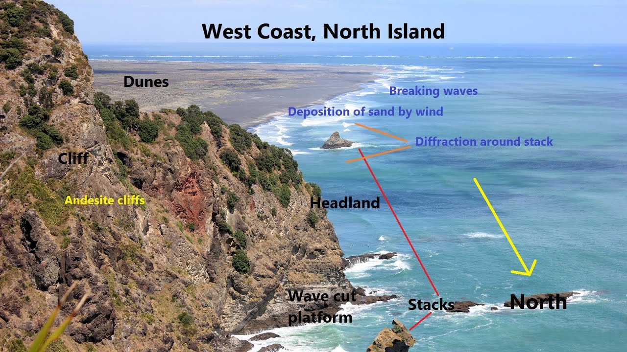
- Describe

- Interpret

Source: https://www.youtube.com/watch?v=Hb_xanCGncY
https://www.geography-fieldwork.org/media/2104898/rivers-annotated-photo-meander.jpg
https://www.geography-fieldwork.org/coast/coastal-management/4-data-analysis.aspx
No comments:
Post a Comment